last updated 18 Jan 2020


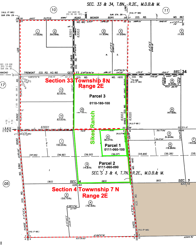
Parcel 1 is where the old house and barns were located.

Description on Deeds:

  1. E. ½ of the NE ¼ of Section 4, Township 7 N., Range 2 E.
  2. W. ½ of the NE ¼ of Section 4, Township 7 N., Range 2 E.
  3. SE. ¼ of Section 33 Township 8 N., Range 2 E.

Note this description, which is on deeds, is wrong and inconsistent with parcels in the assessors map. The correct descriptions are:

Parcel 1 - The NE quarter of the NE quarter of Section 4, Township 7 North, Range 2 East, Mount Diablo base and meridian.

Parcel 2 - The W half and the SE quarter of the northeast quarter of Section 4, Township 7, North, Range 2 east, mount Diable base and meridian.

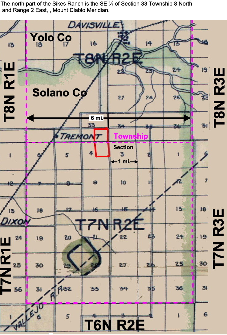
Parcel 3 - The SE quarter of Section 33, Township 8 N., Range 2 E., Mount Diablo base and meridian.

Source: Solano County - View Online Property Information


U.S. Public Land Survey System (PLSS) Township and Range:
The country is divided into 6x6 mile townships consisting of 36 1x1 mile sections.
They are described relative to a central point which is Mt. Diablo for Northern California.
Townships are named in reference to a Principal Meridian and a Baseline. A baseline is a horizontal line and meridian is a vertical line intersecting at Mt. Diablo.
The north part of the Sikes Ranch is the SE ΒΌ of Section 33 Township 8 North and Range 2 East, , Mount Diablo Meridian. Meaning it is the 8th township north of the meridian and 2nd townshipo east of the meridian.

See:
Understanding Township and Range